
CCTV News: China Seismological Network officially determined that at 10:33 pm on October 22, a magnitude 7.0 earthquake occurred in Baqing County, Nagqu City, Tibet, with a focal depth of 10 kilometers. The earthquake was of high magnitude, shallow in focus, and strongly felt. Preliminary verification showed that as of 13:00 on the 23rd, 16 people had been killed and 76 injured.
After the earthquake, the Party Committee and Government of the Tibet Autonomous Region responded immediately, and the Autonomous Region Emergency Command simultaneously launched a second-level emergency response. Nagqu City's emergency response, public security, firefighting, medical, transportation, development and reform, housing and construction forces rushed to the epicenter of the epicenter to carry out various tasks such as search and rescue, treatment, resettlement, and ensuring supply.
Carry out remote sensing monitoring and the risk of large-scale earthquake disasters is relatively low
After the earthquake, the China Natural Resources Airborne Geophysical Exploration and Remote Sensing Center quickly carried out geological disaster risk assessment in the earthquake area. Preliminary research and judgment show that the risk of large-scale collapses, landslides and other geological disasters in the earthquake area is relatively low, but there is still a need to be alert to the risk of secondary disasters on some steep slopes and along roads.
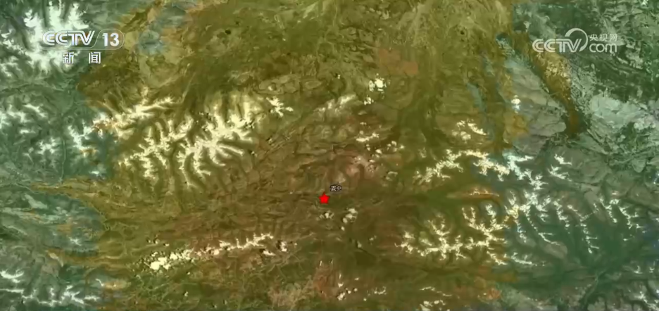
The picture behind the reporter is a satellite remote sensing image before the Baqing earthquake. The earthquake intensity distribution is superimposed on it. The darker the color, the higher the earthquake intensity. According to the current preliminary research and judgment, the risk of large-scale collapses, landslides and other geological disasters in the entire earthquake area is relatively small. However, you still need to be alert to small-scale collapses and landslides on some steep slopes and along roads.
Tu Jienan, a senior engineer at the China Natural Resources Aerophysical Exploration and Remote Sensing Center, said that in areas with relatively steep slopes and villages below, such as those around the epicenter, there is still the risk of small-scale collapses, landslides or rolling rocks, which may block rescue channels. In the future, experts will continue to interpret and analyze post-earthquake collapses, landslides, and debris flows.
Civil and commercial satellite emergency linkage response provides satellite remote sensing images
After the earthquake, relevant units affiliated to China Aerospace Science and Technology Corporation launched the emergency response mechanism and immediately used satellites such as Gaofen-7, Land Exploration-1A, and Environmental Disaster Reduction-2-05 to observe the disaster area, provide satellite remote sensing images, and provide support for disaster relief.
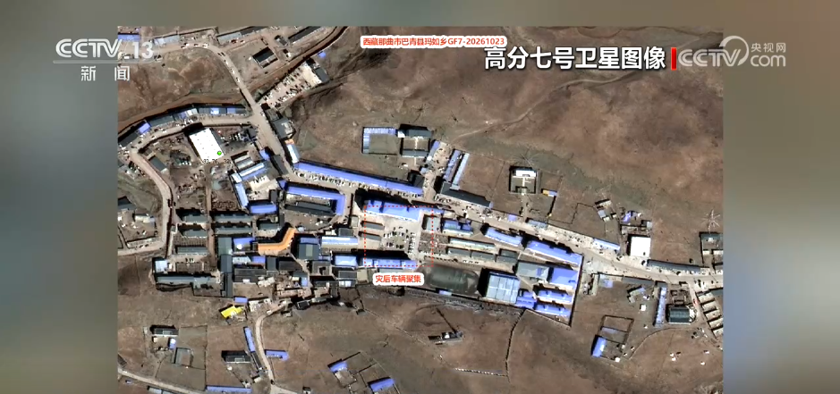
So far, satellite imaging has been arranged 11 times, 21 scenes of post-disaster data have been obtained, and 19 scenes of historical data have been shared to provide support for emergency rescue and decision-making.