On June 10, the Ministry of Transport’s special law enforcement and scanning operation for maritime traffic in the eastern waters of Taiwan Island came to a successful conclusion.
In order to fully fulfill my country's maritime administrative law enforcement jurisdiction, enhance deep-sea patrol law enforcement and traffic control capabilities in key waters, ensure maritime traffic safety, and safeguard national rights and interests, from June 6 to 10, the Ministry of Transport organized the Fujian Maritime Safety Administration, Guangdong Maritime Safety Administration, East China Sea Navigation Support Center, and East China Sea Rescue Bureau to jointly carry out special law enforcement and scanning operations for maritime traffic in the eastern waters of Taiwan Island, carry out maritime patrol law enforcement, and scan and survey key sea areas such as the eastern part of Taiwan Island. This is a necessary action taken in response to Japan and the Philippines' unilateral announcement to launch "maritime delimitation negotiations" east of China's Taiwan Island, which seriously violated China's territorial sovereignty and maritime rights and interests.
my country's 10,000-ton maritime patrol ship "Haixun 09", the Taiwan Strait large-scale cruise rescue ship "Haixun 06", the professional hydrographic survey ship "Haixun 08", and the professional rescue ship "Donghai Rescue 113" jointly carried out this operation, inspected passing ships, reminded ships to abide by navigation rules, and investigated and dealt with various to maintain navigation order; inspect ship navigation facilities, check identification code information of passing ships, and carry out scanning operations in the eastern waters of Taiwan Island; maritime law enforcement officers inspected important anchorages, offshore construction areas, high-risk warning areas for commercial fishing vessel collisions, and waters where submarine cables and optical cables were laid.
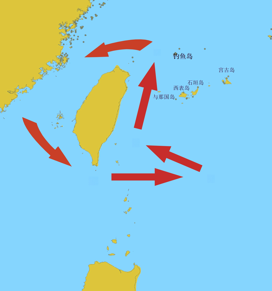
△The picture shows the "Schematic diagram of special maritime traffic law enforcement and scanning operations in the eastern waters of Taiwan Island".
The total voyage of this operation was 1,030 nautical miles, the total scanning mileage was 1,025 nautical miles, 198 passing ships were inspected, and 3 ship violations were corrected. It strengthened my country's patrol law enforcement and traffic control capabilities in the waters east of Taiwan Island, and further improved the level of maritime traffic safety.